
Dane County Neighbor Sources
No official source is a full household roster. DCiMap defines nearby parcels, Access Dane supplies owner and address context, and the Register of Deeds documents changes in legal interests. Election records have separate access rules. Madison's neighborhood organization list supplies civic boundaries and public contacts, not member names. Historical reverse directories can identify occupants for a stated publication year.
| Source | What It Shows About a Block | Access |
|---|---|---|
| DCiMap / assessor viewer | Adjacent shapes, roads, districts and parcel PINs | Free public map |
| Access Dane / local assessor | Owner, mailing, situs and tax context | Free web search; opt-outs apply |
| Register of Deeds | Recorded ownership changes by parcel | Web index from January 1975; older office records |
| MyVote / Badger Voters | Registration or lawful voter-data fields | Self-service or paid data request |
| Neighborhood organizations | Recognized civic boundary and contacts | Public city list, no member roster |
| Reverse directories | Historical address-to-occupant clues | Library, WHS and UW volumes |
An owner can receive tax mail elsewhere, and a person at an address may own no parcel. A road, lake, alley, railroad, shared condominium area, or municipal line can also make the nearest shape a poor match for “next door.” State exactly what the map and record show.
Define Dane County Neighbors
Begin at the target address in Dane County DCiMap. Identify its polygon and copy the parcel identification number, or PIN. Then pan to each touching shape and preserve its PIN and situs address. Situs means the official location of the parcel, which can differ from the address where the owner receives mail.
The live viewer's precise select, measure, and buffer controls were not confirmed in the research capture, so rely on the basic identify-and-click method. A map boundary helps with orientation but does not prove title. For a property question, confirm the legal description or recorded plat. For a numbering question, use the municipality responsible for addresses.
Map a Dane County Block
A reproducible process keeps the project focused on the immediate block and avoids turning a local question into a broad people list.
- Locate the target address and copy its parcel PIN.
- Record each touching parcel, then add relevant corner parcels across the intersection.
- Run every PIN through Access Dane or the correct municipal assessor.
- Save owner role, situs and mailing address, record date, and any privacy note.
- Use the deed index only when a dated ownership change matters.
Use one stopping rule: touching parcels, corner parcels when relevant, and the same street segment between the nearest cross streets. Tax-exempt land, campuses, cemeteries, utilities, vacant tracts, and condominiums need special notes because one map shape may not represent one home. For a whole-road chain, use the Dane County street directory.
Confirm Dane County Parcel Owners
Access Dane offers Owner, Address, Parcel, and Advanced Search modes. For each nearby PIN, capture the owner name if public, mailing or billing address, situs address, municipality, tax context, map link, and record date. The public and agency views are not identical. The county's access-level document says about 97 percent of owner information is published, while residents may opt out of public name and address display.
The mailing address can be more useful than the situs address when locating an owner, but it is not proof of residence. An estate, trust, corporation, prior owner, or off-site person may be listed. A homestead or owner-occupancy flag is evidence of a tax classification at a point in time, not certain proof that a named person is there today.
The Access Dane property portal appears in this capture.
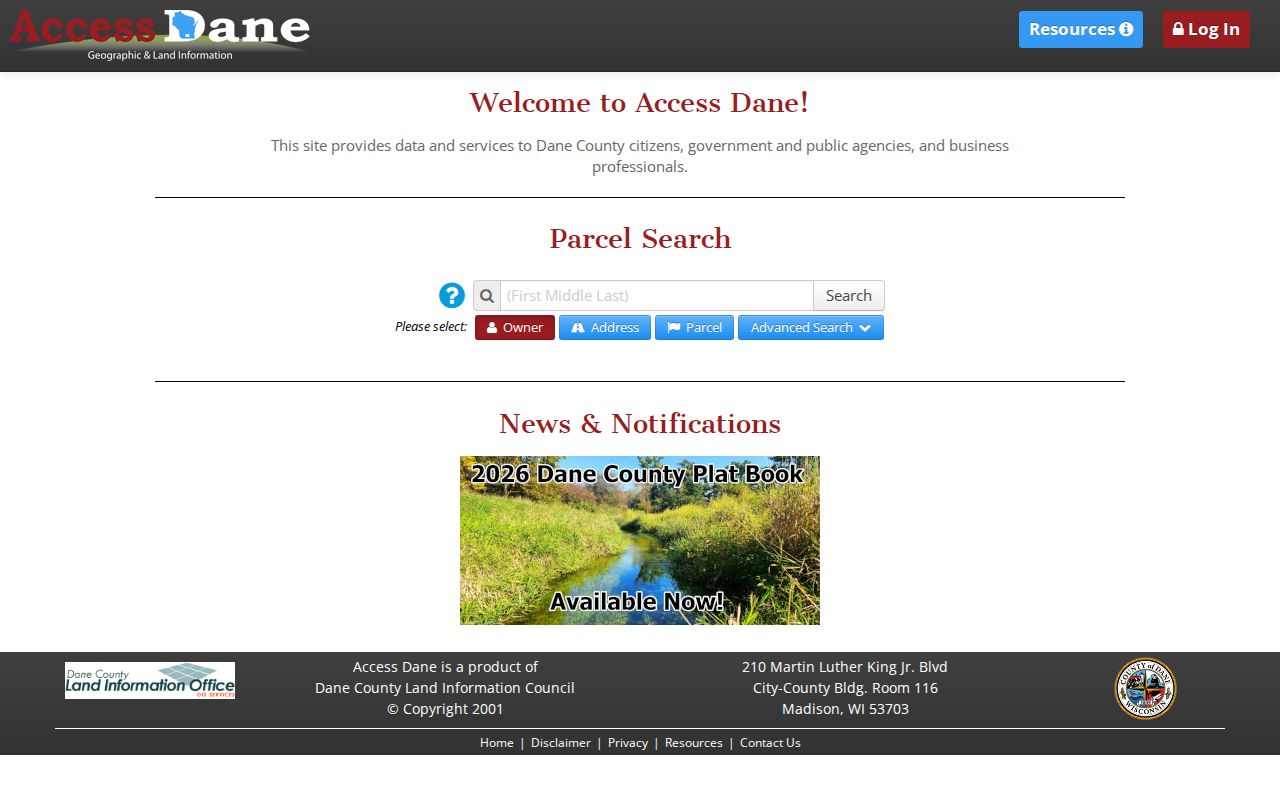
Use the portal after the map so each owner result stays tied to the correct parcel PIN.
Dane County Voters by Address
MyVote supports a registration address mode using street address, unit, city, and ZIP. It is not designed to return every voter on a block. A lawful broader request goes through Badger Voters, where the requester selects a data mode, status, election, county, municipality, district, and ward filters, gets a count and cost estimate, pays, and downloads the available data.
Public voter products can include name, residence or mailing address, status, jurisdiction, ward, district, and participation history. They withhold birth dates, driver-license and Social Security identifiers, requested accommodations, and confidential addresses. Participation means an election record was logged. It never reveals how someone voted.
Dane County Neighborhood Contacts
Madison's recognized neighborhood organization list adds civic context. Its address finder can identify an organization, and groups update public contacts through city staff. The list includes neighborhood associations, homeowner groups, and condominium communities, but supplies no private membership directory. Boundaries are civic guides, not legal parcel lines.
| Organization examples | Useful public clue | What is not supplied |
|---|---|---|
| Allied Dunn's Marsh, Arbor Hills, Bay Creek | Recognized boundary and contact route | Household roster |
| Capitol Neighborhoods, Eastmorland, Greenbush | Meetings and civic information | Proof of parcel title |
| Marquette, Meadowood, Northside, Regent | Current organization contact | Private dues or member list |
| Capitol East, State Street, Williamson-Marquette BIDs | Business-area contacts | Resident directory |
The city map and list are best used to find whom to ask about a public meeting, project, or boundary. A recognized association does not certify who lives on the block.
Historic Dane County Neighbors
Reverse, or criss-cross, city directories organize entries by address or telephone number rather than surname. Madison Public Library, UW Digital Collections, the Wisconsin Historical Society, and Historic Madison can connect an old address to named occupants in a specific year. Pair that clue with a census, deed, obituary, cemetery entry, or yearbook before concluding that two records refer to one person.
Dane's records have an unusual time split. The online Register of Deeds index begins in January 1975, while digitized Madison directories reach back to 1858. That gap does not mean older ownership records vanished. It means research may shift to office books, microfilm, printed directories, or historical collections.
Dane County Neighbor Tools Compared
Official rolls and commercial neighbor tools answer different questions. Primary records preserve a named custodian, field meaning, identifier, and date. Compiled products may merge people, repeat old addresses, or omit protected residents. They may be quick, but they are weak proof.
| Source type | Strength | Key limit |
|---|---|---|
| Parcel and deed records | Named custodian and parcel identifier | Owner is not always occupant |
| Voter records | Registration status and jurisdiction | Protected fields and voters are withheld |
| Civic organizations | Public contact and local boundary | No private roster |
| Compiled commercial data | Broad name and address leads | Unclear sources, dates, and merged identities |
Dane County Neighbor Privacy
Parcel records usually omit renters, boarders, children, and other household members. Utility customer lists are not public household directories, and federal law restricts motor-vehicle address data. Safe at Home, Wis. Stat. §165.68, provides eligible people with an assigned address. Confidential-elector rules under Wis. Stat. §6.47 can also shield an actual address.
A sound block worksheet records PIN, situs address, public mailing address, owner role, latest deed document, permit number and date, neighborhood association, ZIP, municipality, source date, and privacy note. Leave a blank when an official source discloses nothing. Date the map and every record because a sale, split, consolidation, reassessment, or street change can alter the result.
Lawful use. Research Dane County neighbors only for lawful civic, historical, or personal purposes. Never watch, harass, threaten, or expose a protected person.