
Dane County Previous Resident Sources
Choose sources by era and by the claim being tested. The current parcel record supplies the starting identity. Recorded deeds establish ownership transfers. Directories and census schedules can identify occupants, including people who never held title. Maps and permits explain changes to the structure or address.
| Source | Years It Covers | Where Held | What It Shows |
|---|---|---|---|
| Dane real-estate index | January 1975 to present, with back-indexing ongoing | Register of Deeds, Tapestry, Laredo | Grantor, grantee, document data, and many images |
| Madison directories | Digitized 1858 to 1921; complete physical set | UW, Madison Public Library, WHS | Occupant, spouse, work, address, and reverse clues |
| Federal census | Released schedules from 1790 to 1950 | NARA and library databases | Names, ages, household links, birthplace, and tenure |
| Sanborn map | Verified Madison item from August 1902 | Library of Congress | Footprint, material, use, number, and block form |
| Madison permits | Current reports; historic cutoff not stated | City reports, Accela, or request | Work, dates, status, and named project roles |
| News and obituaries | Local index May 1966 to April 1996; broader runs vary | Library, WHS, and microfilm | Moves, deaths, family ties, sales, and probate clues |
| DCHS drawings | Schneider drawings 1912 to 1970s; Kronenberg collection | DCHS digital collections and archives | Plans and building context, with project-related names |
Start with the newest reliable parcel card even when the question concerns the distant past. Its PIN, municipality, lot, block, and legal description prevent a modern address from being matched to the wrong earlier property. Then pick the next dated source from the table.
Walk Dane County Deeds Backward
The deed chain is the legal spine of a previous residents search, but it identifies owners rather than every occupant. Begin at Access Dane or the proper municipal assessor. Save the public owner field, situs, tax mailing address, PIN, municipality, subdivision, lot, block, and date searched.
- Find the current owner's acquisition in the Register of Deeds index. Copy the grantor, grantee, date, document number, legal description, and PIN.
- Search that seller as a grantee. This should locate the deed through which the seller acquired the parcel.
- Check the legal description at every link. Similar names or nearby street numbers do not prove the same parcel.
- Repeat the grantor-to-earlier-grantee loop until the web index reaches its January 1975 boundary.
- Ask ROD staff for deed books, microfilm, volume and page references, or legal-description searching for earlier links. WHS and FamilySearch can supplement the office path.
- Grantor and grantee
- The grantor conveys an interest; the grantee receives it.
- Chain of title
- The linked series of recorded transfers for one parcel.
- Legal description
- The land identity based on lot, block, subdivision, survey, or boundaries. It can survive an address change.
Mortgages, satisfactions, liens, land contracts, and UCC filings may add context, but they are not automatically ownership transfers. A deed return address may show where a document should be sent, not where a party lived.
Dane Records Before 1975
January 1975 is the published starting point for Dane County's online real-estate index. It is not the date local recording began. Tapestry can search records from 1972 forward by name, but a successful search costs $8.75 plus $1 per page to view or print, and its copies are not certified.
At the office, take the party names, legal description or address, and approximate year. Mail requests should provide a document number, volume and page, year, and page count, with payment and a stamped return envelope. The county says mail fulfillment takes about two weeks. Uncertified copies cost $2 for the first page and $1 for each extra page; certification adds $1.
The Dane County online index page shows the systems and cutoff used for this handoff.
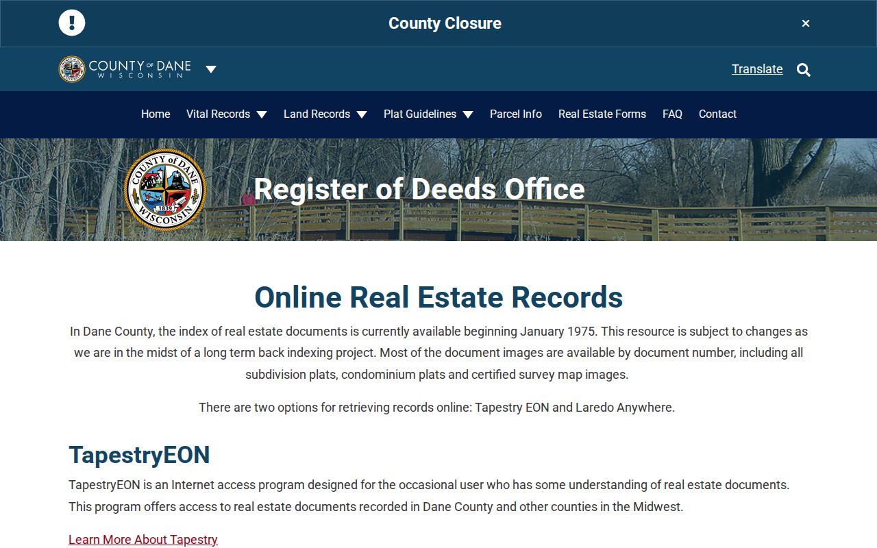
When the digital trail ends, the correct response is to change access channels, not to assume the property has no older record.
Note: Keep volume, page, document number, and legal wording in the research log so each offline request remains narrow and checkable.
Dane Previous Residents House Method
Historic Madison's house-history method begins with city and reverse directories, then combines owner names and addresses with newspapers, census schedules, deeds, maps, assessment records, and Register of Deeds material. It is a method and referral list, not a separate paid research service.
Madison Public Library holds the complete printed directory set, while UW Digital Collections provides the verified 1858 to 1921 run. A reverse section turns an address into a year-specific occupant clue. The collection details belong on the Dane County city directory page; for house history, transcribe only the entries tied to the target parcel and dates.
A Dane House in 37 Sheets
A single August 1902 Madison Sanborn item contains 37 sheets. It can turn an address trail into a physical building history by showing footprints, construction materials, uses, street numbers, hydrants, hazards, and block layout. Only that direct Madison year was verified in the official source set.
Use a Sanborn sheet beside the 1900 to 1901 Angell directory and the 1900 federal census. The directory supplies a dated person and address. The census tests household composition and tenure. The map tests the structure and block. Each source keeps its own date, so the three records support one another without being merged into a claim none of them makes alone.
Dane Address Permits Mark Change
Madison permit reports can establish when work was issued or completed at an address. A result may show the permit number, work description, issue and final dates, contractor or applicant, inspection status, and a public owner field. The named person must be labeled by that role. A contractor did not necessarily own or occupy the building.
The current online reports and Accela route do not state one verified historic cutoff. Ask the municipality for older or unindexed files using the address, PIN, work type, and date range. Permit evidence can explain an addition, demolition, conversion, or other break between maps and directories, but it cannot replace a deed in the ownership chain.
Bridge Dane Address Changes
Street names and numbers may change after a subdivision, annexation, route change, or municipal handoff. Madison City Engineering maintains address maps and databases, and its official map includes alternate street text, change arrows, municipal limits, plats, lot numbers, and certified survey map references.
No official source reviewed identified one systemwide Madison or Dane County renumbering year. Bridge a suspected change with the official Madison map, old directory street sections, plats, and the stable legal description. Dane County has more than 60 municipalities, so a postal city name must not be confused with the parcel's legal jurisdiction.
Dane Previous Residents and Households
Owners are only part of a house's human history. Directories and census schedules can identify past residents who did not own the parcel. Directory years are not always annual, and a line describes the publication period rather than an exact day. Copy the original spelling, initials, spouse notation, work, street number, direction, and any owner, renter, boarder, or widow mark.
Pair the closest directory with a released census schedule, while respecting the gap left by the mostly destroyed 1890 census. A practical sequence is 1871 to 1872 directory with the 1870 census, 1883 to 1884 with 1880, and 1900 to 1901 with 1900. Later released censuses extend through 1950 under the 72-year rule.
- Copy the exact reverse-directory entry for the target address and year.
- Search the named entry for surname variants and spouse notation.
- Open the nearest census schedule and compare address, household names, ages, birthplace, work, and tenure.
- Record conflicts instead of forcing a match. A move, publication lag, boundary shift, or changed number may explain the difference.
- Use a deed only for title, then use news or probate records to explain a later move, death, or estate.
Obituaries may connect a deceased occupant with a spouse, children, funeral home, or later community. The Wisconsin Historical Society's indexes often give a citation rather than an image, while local microfilm can supply the article. A probate case may identify heirs, attorneys, or an estate address, but sealed or protected details remain unavailable. Request only the releasable documents tied to a known case number.
Keep an evidence grid for every past resident: source date, exact name, address form, role, PIN or legal description, record number, and confidence. One row might identify a directory occupant, while another names a deed grantee. A later obituary may link the same surname to a spouse, but it does not prove that each matching name is one person. Compare municipality, initials, household members, work, and dates. If the sources cannot separate two people, leave the link unresolved. This dated grid is especially useful when trusts, estates, corporate owners, or changed street numbers interrupt an otherwise simple trail.
Lawful use. Research previous residents for family history, house history, or personal curiosity. Do not use a historic trail to track, harass, threaten, or harm a living person.
A finished Dane County previous residents timeline should keep one row per source date, state each person's role, and cite the parcel or document key. When evidence conflicts, mark the identity unresolved. That restraint makes the house history more accurate and protects living people from false claims.