
Search Dane County by Street
A street search works best as a chain of dated records. The assessor identifies a parcel and the owner field available to the public. DCiMap fixes that parcel on the ground. The Register of Deeds then connects recorded transfer parties to the same legal description. Election tools and old reverse directories can add evidence about residency, but neither should be treated as a complete list of everyone inside a home.
- Enter the house number and street in Access Dane, or use the Madison assessor when the parcel lies in Madison. Save the PIN, situs address, municipality, public owner field, and search date.
- Open the parcel in Dane County land information or DCiMap. Identify the polygon and copy PINs for the next parcels when the task covers a street segment.
- Compare the situs address with the mailing or billing address. A different mailing address is useful owner context, but it does not prove where that owner lives.
- Search the latest owner and the legal description in the Dane County deed index. Follow grantor and grantee roles to establish transfers.
- Use voter tools only within their stated access rules. For past occupants, consult the year-specific reverse sections described on the Dane County city directory page.
This order prevents a common error: turning a property owner into a claimed current resident. Each source has its own date and role. Record those details beside every name found.
Dane County Address Search Fields
Access Dane offers Owner, Address, Parcel, and Advanced modes. Inside Madison, the city assessor exposes a precise address form and an address-range option. That range search is especially useful for a street directory because it can inspect a bounded run of house numbers without guessing at owners.
| Field | Control | How to use it |
|---|---|---|
| House Number | Text, required | Enter one number for a single parcel. |
| Street Direction | Select, optional | Choose N, S, E, or W when the address uses it. |
| Street Name | Text, required | Use the base name without inventing a suffix. |
| Street Type | Select, optional | Use the form's current option list. |
| Unit | Text, optional | Separates apartment or condominium units. |
| Address Range | Beginning and ending numbers | Searches a defined street segment. |
| Owner | Last-name text | Accepts forms such as Smith, J. |
| Parcel Number | Text, required | Uses the full numeric parcel identifier. |
The resulting parcel card may include owner, mailing address, situs, PIN, assessment and tax context, plat name, exemption indicators, and map links. Public fields vary. Dane County reports that most owner information is published, while also allowing an owner to opt out of public display.
The Madison property search is shown below. Its range controls make a named street easier to inspect than a name-only directory search.
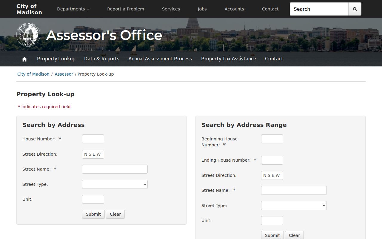
Use the form to obtain a parcel key, then verify the returned record's date and jurisdiction before following any person name.
Read Dane County Parcel Language
An address can appear in several forms. The postal label moves mail. The situs address locates the parcel. The tax mailing address tells where correspondence goes. A legal description identifies land through a lot, block, subdivision, certified survey map, or metes-and-bounds wording. Treating these as interchangeable can send a street search to the wrong place.
- Parcel or PIN
- The parcel identification number used to connect assessment, map, and some deed records.
- Situs address
- The physical address assigned to the parcel, which may differ from an owner's mailing address.
- Plat
- A recorded map that identifies lots, blocks, boundaries, easements, and subdivision geometry.
- Criss-cross directory
- A historical directory arranged by street or address rather than only by a person's surname.
Preserve Dane PINs exactly as printed. County guidance explains that municipality codes and formats vary by context. The PIN and legal description are the durable bridge when a street number or municipal label changes.
Map Dane County Street Parcels
DCiMap adds geography to the street directory. Find the address point, zoom to its parcel, identify the polygon, and copy its PIN. Repeat that step for adjacent polygons. The county land-information ecosystem includes parcels, address points, roads, zoning, floodplain, districts, parks, survey maps, and open-data links.
A boundary line is not proof of ownership. Use the map for position, then return each PIN to Access Dane or the relevant municipal assessor for the dated record. Corner parcels, condominium common parcels, public land, and farm tracts may not behave like a row of single-house parcels.
Note: Record the map date and each PIN so a later parcel split, sale, or reassessment does not silently alter the street list.
Dane County Street Record Sources
No address source answers every question. The following records differ in keeper, time span, and meaning. Together, they let a street directory distinguish parcel ownership, recorded transfers, map context, construction activity, and historical occupant clues.
| Source | Dane custodian | Street evidence | Access route |
|---|---|---|---|
| Assessment parcel | Access Dane or municipal assessor | Public owner, situs, mailing, value context, PIN | Free web search; municipal variation and opt-out |
| GIS layers | Dane LIO / DCiMap | Parcel shape, roads, zoning, flood and district context | Public viewer and open-data links |
| Deeds and plats | Dane Register of Deeds | Transfer parties, legal description, PIN, lot and block | Online index from January 1975; office and copy routes |
| Permit reports | Madison or local municipality | Address, work, status, dates, and named project roles | Reports, Accela, or a narrow records request |
| Voter records | WEC and municipal clerks | Registration evidence under protected-field rules | MyVote or lawful Badger Voters request |
| Reverse directories | Madison Public Library, UW, WHS | Year-specific address-to-occupant clue | Digitized or physical volume |
Use the record's own label. A deed names a grantor or grantee. An assessment names an owner. A permit may name an applicant or contractor. None alone supplies a complete household roster.
Trace Dane County Streets in Deeds
The Register of Deeds web index starts in January 1975, with back-indexing still underway. Search the latest owner as grantee, capture the deed's document number and legal description, then search the seller as a prior grantee. Search grantor and grantee roles separately. Older deeds may omit a modern street address, so PIN, lot, block, subdivision, and legal wording matter more than the typed street name.
The online service separates occasional Tapestry use from Laredo Anywhere for frequent users. Tapestry searches records from 1972 forward by name and charges $8.75 for a successful search plus $1 per viewed or printed page. Those copies are not certified. The county counter can provide uncertified copies for $2 on the first page and $1 for each added page; certification adds $1.
For older records, visit the office with party names, legal description or address, and an approximate year. A mail request should identify document number, volume and page, year, and page count, then include a money order and stamped return envelope. The county estimates about two weeks. This fallback is vital when a street directory reaches the online cutoff.
The Dane online record-search page illustrates the 1975 boundary and available systems.
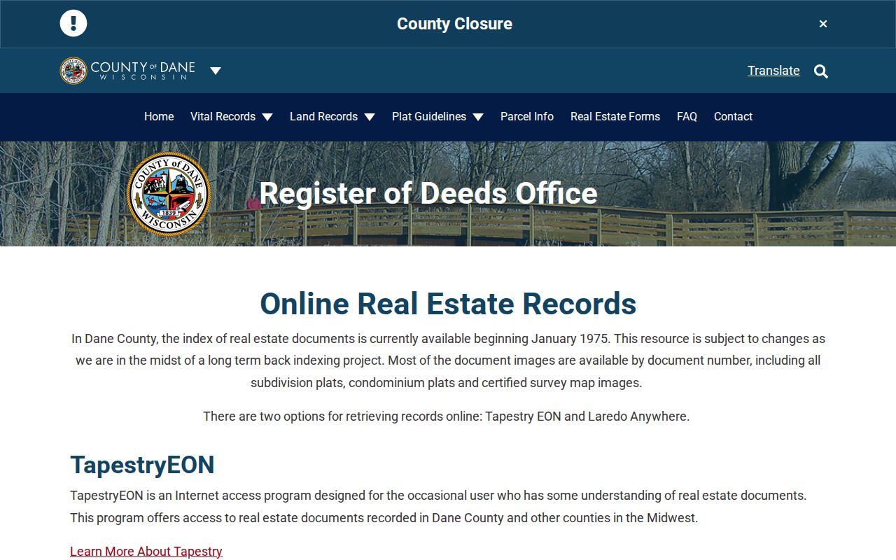
The cutoff shown there marks online index coverage, not the start of recorded land history in Dane County.
Dane County Street Name Changes
Madison City Engineering assigns and maintains parcel addresses under its local rules and works with USPS. The official map includes municipal limits, street names, alternate text, change arrows, plats, lot numbers, and certified survey map references. These tools can bridge an old directory spelling to a current parcel.
No official source reviewed supplied one countywide historic renumbering year. Dane County includes more than 60 cities, villages, and towns, along with rural and unincorporated areas. A Madison postal label may not equal Madison municipal jurisdiction. If an old number fails, compare Madison's official map service, a period street section, the recorded plat, and the legal description. Do not guess a conversion year.
Dane Street Voter and Permit Clues
MyVote supports a registration question, not a free list of all voters on a block. Wisconsin's electronic registration list is public under state law, but dates of birth, identification numbers, protected addresses, and requested accommodations are withheld. Confidential electors and Safe at Home participants require special treatment. Participation data never reveals a person's ballot choice.
Madison permit reports add a different address layer. Current results may show permit number, issue and final dates, work description, applicant or contractor, status, and address. Use those facts as evidence of work at a site, not as proof of ownership or occupancy. For old or unindexed records, contact the city or municipality with a narrow address and date range.
Note: A lawful request for a street segment should name the address range, record type, date span, desired format, and known parcel numbers.
Dane Street Directory Time Gap
Dane's digital and printed records overlap unevenly. The deed web index reaches back to 1975, while digitized Madison directories reach 1858 through 1921. That 117-year contrast explains why one quick web search cannot cover a street's full past. Later printed directories are held at Madison Public Library, but the exact volume sequence must be checked year by year.
For historical address work, choose the correct directory year and inspect its reverse or street section. A line may give an occupant, spouse, work, phone, or address as the publisher recorded it. Directory publication was not reliably annual before 1950, so a missing year does not prove a household moved. Deeds establish transfers; directories provide dated occupant clues.
Dane Street Directory Limits
An assessor record is not a census of a home. It can omit renters, boarders, relatives, and unregistered occupants. An owner may be an estate, trust, company, or person who receives tax mail elsewhere. A homestead indicator, when present, reflects a classification or claim at a point in time, not certain proof of current residence.
DMV address data is restricted, and utility customer information is not a public household directory. Access Dane also permits opt-out from public owner-name and address display. Safe at Home and confidential-elector protections can substitute or withhold addresses. Blank fields must remain blank rather than being filled from inference.
Lawful use. Use Dane County address records only for lawful personal research. Never use a street search to stalk, harass, threaten, or harm anyone.
A sound Dane County street directory result states the role and date: listed owner, deed party, permit participant, registered-voter record, or historical occupant. That wording keeps the evidence useful without claiming more than the public record shows.